4 hours of running over rough, pathless, tussocky grass with leg burning ascents and knee wrecking descents. Maybe running is an exaggeration, I doubt I ran more than half of it and that was only when it was flat or downhill.
The Kong Mini Mountain Marathons are essentially mountain orienteering events. You are handed a map showing checkpoints with different values and you have to visit as many as possible in 4 hours. You choose your own route and there is not time for even the fastest to visit all the checkpoints. The further away the checkpoint, the higher the value, and points are deducted if you come back in over 4 hours. It’s a great test of route planning, fitness and navigation and I love them.
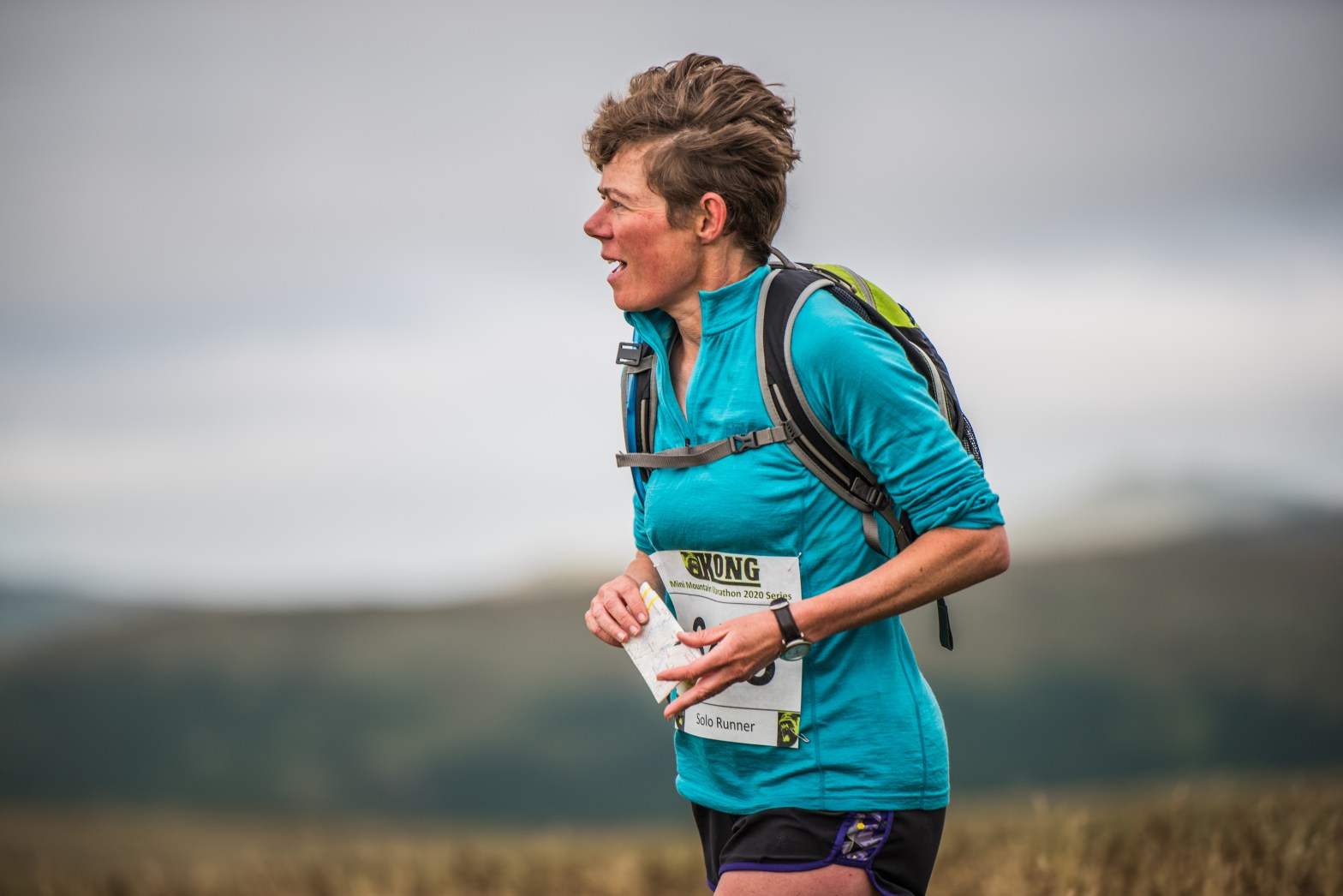
You can start the event when you like and I’d chosen to start between 9am and 9.15am. I arrived at Tebay in plenty of time and walked up to registration to get my number, my dibber and have my kit checked. The dibber is an electronic device attached to your wrist that you “dib” into each checkpoint to prove that you’ve been there. The kit check is usually quite strict – full waterproofs, hat, gloves, survival bag, compass, whistle, food and water – hypothermia affects even the best runner if they are injured or ill. Then I walked out of the village and up the track to the start.
When it was my turn to start I dibbed my dibber to record my start time and only then was handed the map with the checkpoints. It’s a mistake to rush off too quickly at this point, the key to doing well is to plan a route that visits as many checkpoints as possible whilst minimising ascent and distance. Just the sort of optimisation problem I used to enjoy in my maths degree…..
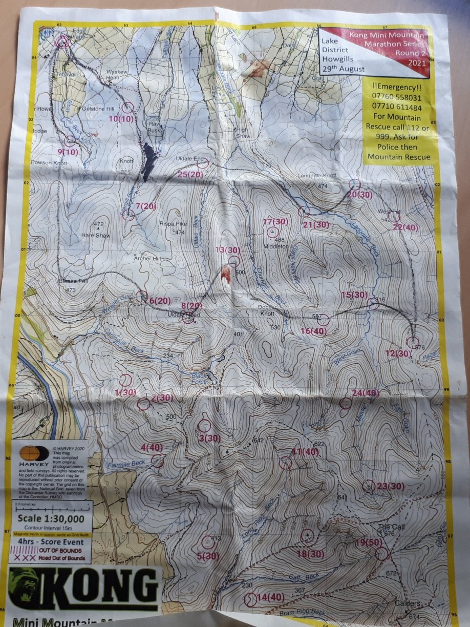
I decided on my route and set off up the track to the first check point. There tend to be other people at the first few checkpoints, then it gets quieter as everyone goes different ways and eventually you have the place to yourself. Very few of the checkpoints are on paths, but they are usually at obvious features such as sheepfolds, stream junctions or ring contours. The map scale was 1 to 30,000 which made for some interesting distance calculations. I’d measure the distance to the next checkpoint in mm, start running and then do the calculations in my head whilst trying not to trip over the tussocky grass.
After the first 3 checkpoints I revised my plan slightly. The 4th checkpoint involved a lot of ascent and descent and I didn’t think it was worth the time and energy for 30 points. So I skirted round the bottom of the hill and went straight to my 5th checkpoint in a sheepfold. Then it was over a river and up the first of many steep, rough ascents. I don’t run fast but I noticed I was walking up the hills significantly faster than most of the club runners and was making better route choice decisions over rough ground.
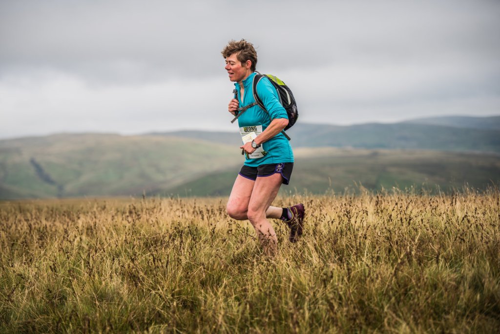
Just before the next checkpoint I twisted my ankle. That was going to happen at some point wearing trainers on this kind of terrain. I kept on going and ignored it. I was up on a broad grassy ridge now and could finally do some good running along a grassy track, gently downhill, with good views over the hills before a short steep climb to the next checkpoint.
Then came the first long, steep and rough descent and I slowed right down. Descents are my weak spot, even when walking I go slower and I sometimes use a pole. No poles today and I was soon being overtaken. I focussed a bit more and went a bit faster. After a checkpoint at the stream junction at the bottom I crossed the stream and went straight back up the other side of the valley where I overtook the others again. The summit checkpoint was my high point of the day at 587m and was worth 40 points. Then more down and back up, the checkpoints seemed carefully placed to make the running as hard as possible.
I had 3 checkpoints to go plus an optional 4th if I had time but the optional one was next and involved a small detour. If I made the wrong decision here and came in at over 4 hours I would quickly lose points. Nothing like a bit of pressure.
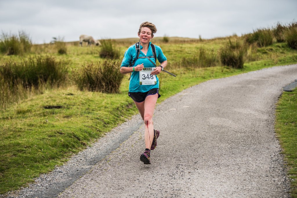
I decided to go for the optional checkpoint. Another descent and reascent followed, the last of the day, followed by 2 checkpoints in quick succession. I had half an hour left and over 4km to go, mostly down hill, mostly over rough ground. I wasn’t sure I was going to make it, but I was going to try. Then disaster struck. I was flying down a steep gravelly track with 15 minutes to go when I tripped up, fell heavily and went down with a bang. It hurt. But I had no time to waste so I jumped up and carried on, ignoring the blood running down my leg and the pain in my knees, chest, hand and elbow. I rounded one final corner and there was the finish. I had 3 minutes to spare.
I was 5th female out of 72 which I was delighted with considering the majority of my competitors were younger than me. I studied the map at leisure later and couldn’t see how I could have improved on my route. I also measured my route – 22km and 1300m of ascent in 4 hours. But I also knew I had pushed myself a bit too hard……

I like that “dibbed my dibber”!
LikeLike