I love maps. I have always loved maps. As an eight year old my friends had posters of pop stars on their bedroom walls and I had maps of Europe which I studied in great detail every night. I loved the colours, the contours, the detail, the foreign place names, the promise of exploration and travel. I studied the road atlas on family car journeys and learned to navigate. Later I ventured into the hills and instinctively followed maps without being taught what to do. From one glance at the map I could visualise the landscape, translating contours into a 3D image. I pored over historic maps, fascinated by how the landscape has changed. I saw maps as a work of art, especially some of the Swiss and Austrian maps.
Forty years later my love of the mountains has grown and I use maps for more practical purposes. Over the last few years I have grown to love the ViewRanger app and have spent hours poring over my phone, planning routes in the hills and identifying new areas to explore. The ability to have maps for the whole of the UK at my finger tips has been a huge step forward, as has the ability to find the distance and ascent of planned routes without using string and counting contours. I still use paper maps whilst on the hill, preferring not to rely on a phone battery that dies in the cold or a screen requiring bare, cold fingers to swipe, but I use ViewRanger to plan all my routes and as a backup in an emergency. I also use it during my micro navigation sessions to check I have arrived at my intended location. I’ve always found it easy to use, not cluttered with unused features and reasonably priced.
ViewRanger was taken over by Outdooractive in 2021 and will be discontinued in February 2022 much to the disappointment of the outdoor community. Rather than moaning about the loss of ViewRanger I decided to review what else was on offer to help me choose which app to use instead. I selected OS Maps, Memory Map and Outdooractive as my three options and tried them all on my Android phone. I have not reviewed them on a PC.
OS Maps
This is an App available directly from the UK Ordnance Survey and as such gives access to UK OS maps only. I’ve had a subscription to OS Maps for a few years but haven’t used it much preferring ViewRanger. It’s good value at £23.99 per year for access to all 1:25,000 and 1:50,000 OS maps of the UK. The app is easy to use but rather simplistic. There is the ability to pinpoint your current location, plot a route and record a route, but not a lot else.
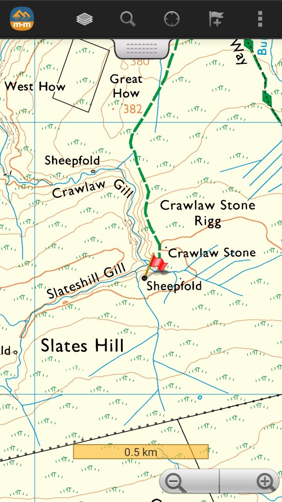
For years I thought there was no way of finding a grid reference using OS maps but I’ve now found that if you hold your finger on a point on the screen the grid reference appears together with northings and eastings. It is hard to pinpoint an exact location with a large finger without zooming right in so again it is a simplistic solution and the location is obscured by a large “Record Route” black circle which isn’t ideal. It is also possible to locate a grid reference by entering it into the “Search” option.
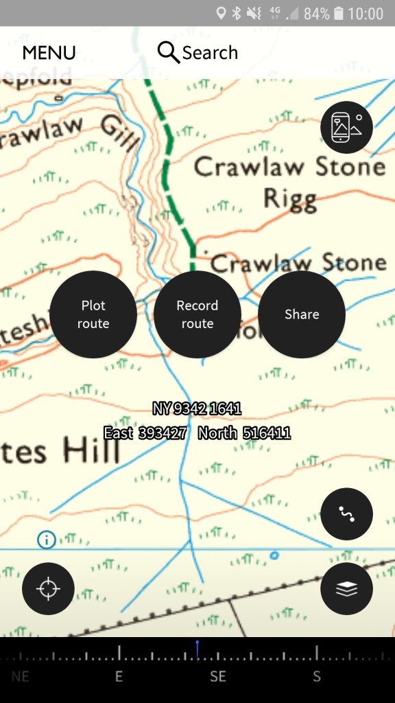
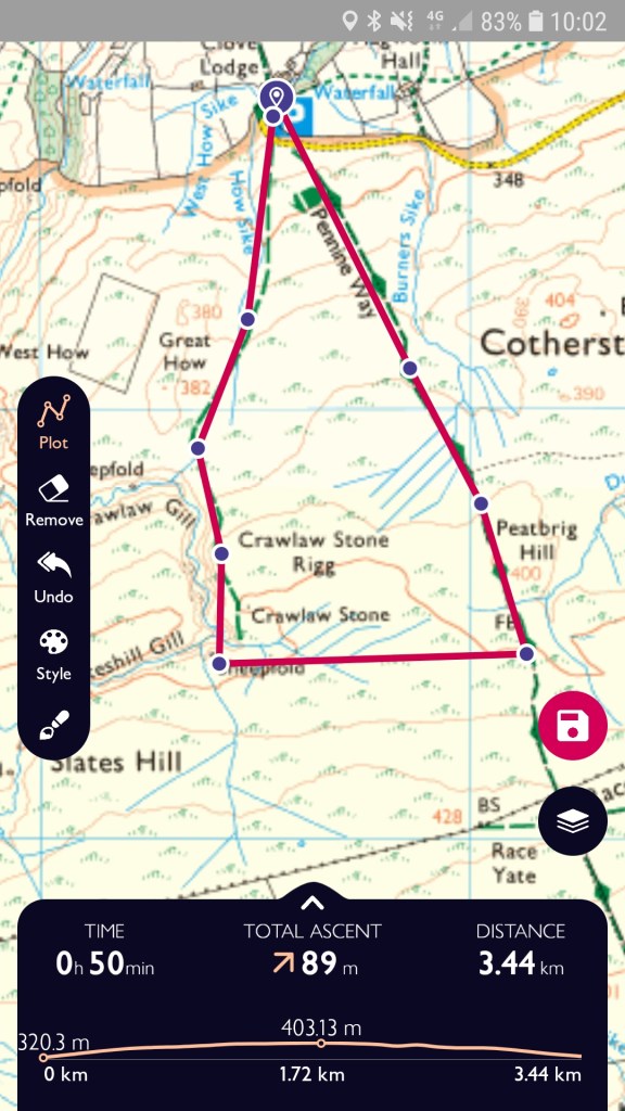
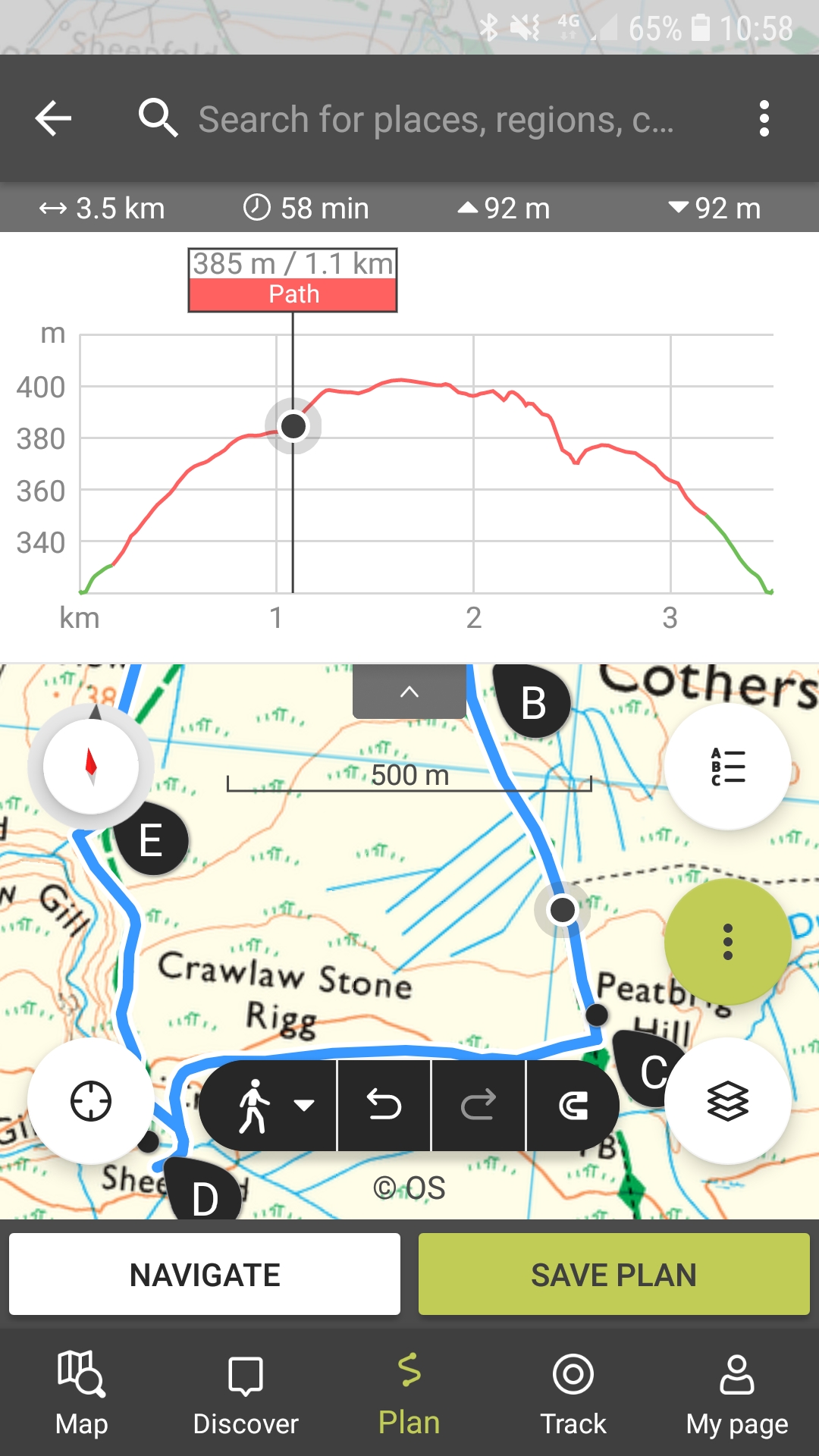
Plotting a route is easy by selecting “Plot a route” from the Menu and tapping the screen to select the start point and subsequent waypoints. Basic data for the planned route is shown on the screen including total ascent, descent, distance and estimate time. The time is based on your selected speed which can be altered in Settings. There is a also a simple elevation profile.
All three apps rely on a 4g signal or internet connection but in OS Maps there is the option to download the maps in small sheets for use offline. The small sheets will save phone memory but it would take a while to download the maps for a large area.
The one feature I do like in OS maps is the ability to select the scale of map. You can choose between auto zoom where the map scale changes from 1:25,000 to 1:50,000 as you zoom out but you can also choose to lock the map to 1:25,000 or 1:50,000. I often prefer to use 1:50,000 maps in Scotland to get a better idea of the main features but like to zoom in as my eyesight is not as good as it used to be. It can be irritating when the mapping app decides itself what scale map you should be looking at.
Other features include augmented reality and fly throughs, nice to have but not necessary.
OS Maps has all the basic features and will be perfectly adequate for a lot of people, but it doesn’t offer the same quality as ViewRanger.
Memory Map
Memory Map was founded in the USA in 2000 and aimed at the marine and outdoor community. There are a number of subscription options for the UK community with the option of an annual licence or a perpetual licence. The annual licence gives you access to OS maps for 1 year including updates as they come out. Current prices are £20.83 + VAT for 1:25,000 OS maps only and £33.33 + VAT for 1:25,000 and 1:50,000 OS maps. The perpetual licence gives you the ability to use downloaded maps forever but without any updates. The current prices for this are £74.99 + VAT for 1:25,000 OS maps only and £124.99 + VAT for 1:25,000 and 1:50,000 OS maps.
My initial impression was of the quality of the map. OS maps and even ViewRanger maps can get blurred when you zoom in or out but the Memory Map is exceptionally clear at all zoom levels. The maps also download as you view them, which has its own pros and cons. It saves time and faff not having to download specific areas, but you can end up with small white areas in offline mode that you haven’t viewed online so it is worth going to offline mode and checking that you can see the whole area.
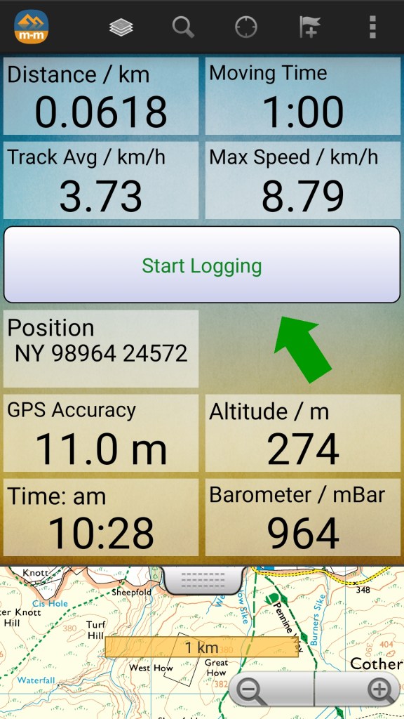
There is also an exceptional amount of data available and you can select which data you wish to view in the “Dashboard”. I particularly liked the barometer and the GPS accuracy data which isn’t available on other apps. Other data includes grid reference, time, altitude, speed and lots of maritime data.
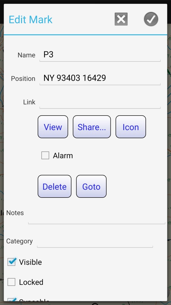
To find the grid reference of a point you need to place a mark on the screen in roughly the right location and then you can pin point the exact location by moving the mark on the screen using the arrow function giving a more accurate grid reference than OS Maps. If you want to find out where a particular grid reference is, you place a mark anywhere on the screen then click “Edit” , overtype the current grid reference with the desired grid reference and then click “View”. This is a bit unwieldy and where Memory Map starts to fall down.
It is easy to plot a route by placing waymarks on the screen but when complete the only data given is the distance of the planned route. This is a complete showstopper for me as I need to know the ascent involved on planned routes, especially on backpacking trips where I’m carrying a fair bit of weight and I’m not going back to counting contour lines. There is also no option to track your route and although I’ve never used this option much on ViewRanger I know that other people do use it and I can see that the lack of this option will be another showstopper for a lot of people. There is the option to “Follow” your planned route and you will be given distance and bearings from one way mark to the next, which again is a bit basic.
Overall, I was disappointed with Memory Map. The clarity of the mapping and the amount of technical data is completely let down by the basic route planning tools and the lack of a tracking option. I get the impression that it is older style software primarily aimed at marine use and the subscription cost is higher than the alternatives. I did like the barometer and I’ve now found a free app to measure atmospheric pressure so the trial hasn’t been a complete waste of time.
Outdooractive
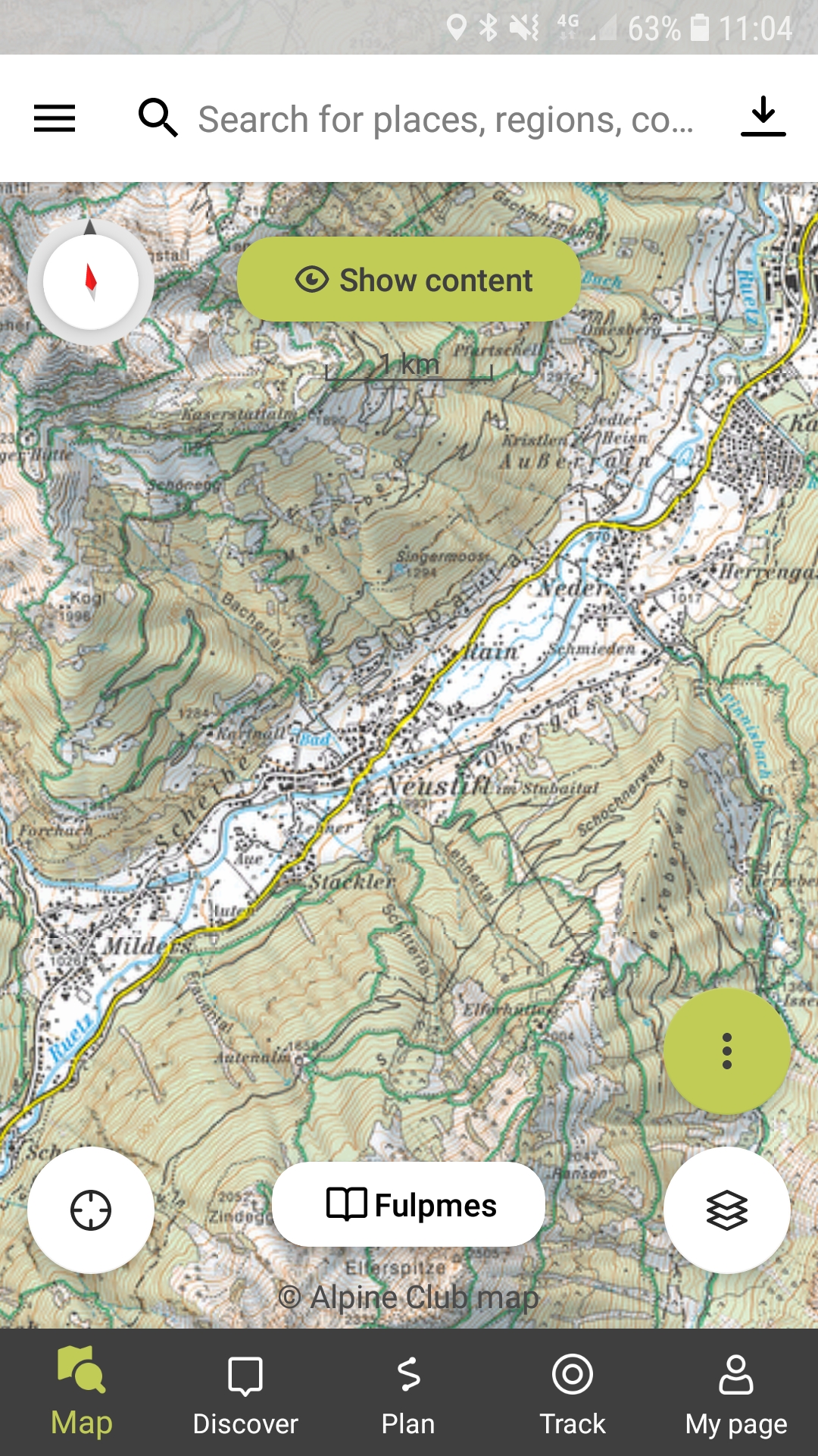
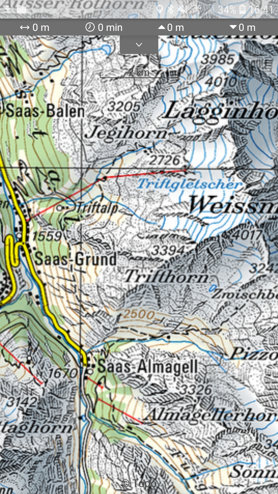
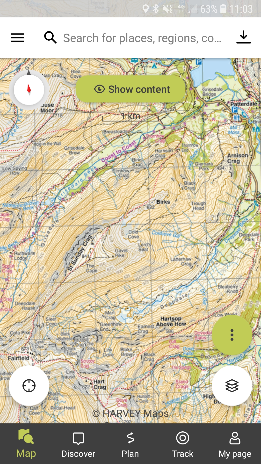
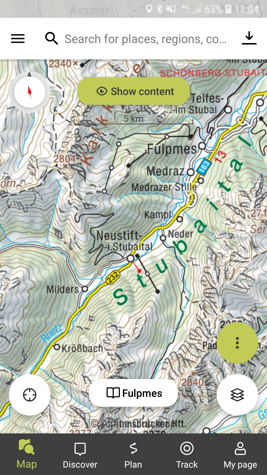
This is the much criticised replacement for ViewRanger and it has a distinctly European feel to it. It’s been around since 1994 and was originally developed for the European market, in particular German speaking areas. It now gives worldwide map coverage but still retains a focus on the alpine club maps for Germany, Austria and Switzerland which from my point of view is a huge plus as hopefully one day I will return to my high mountain walking in the Alps. For the UK it offers 1:25,000 and 1:50,000 OS maps and also Harvey maps which again is a bonus.
There are different subscription levels. There is a free version which gives access to Openstreetmap data only. The next level is the Pro version which for £2.23 per month gives access to all OS maps, French IGN maps and Swiss topo maps as well as the standard Outdooractive map which is good value. This also gives access to the BuddyBeacon option, augmented reality and the option to download maps for use offline. This would be sufficient for most UK users. The Pro+ version is £4.45 per month and offers all the features that come with the Pro version plus access to UK Harvey maps and for Europe, German and Austrian Alpine Club maps and Kompass maps. All versions allow you to plan and track routes.
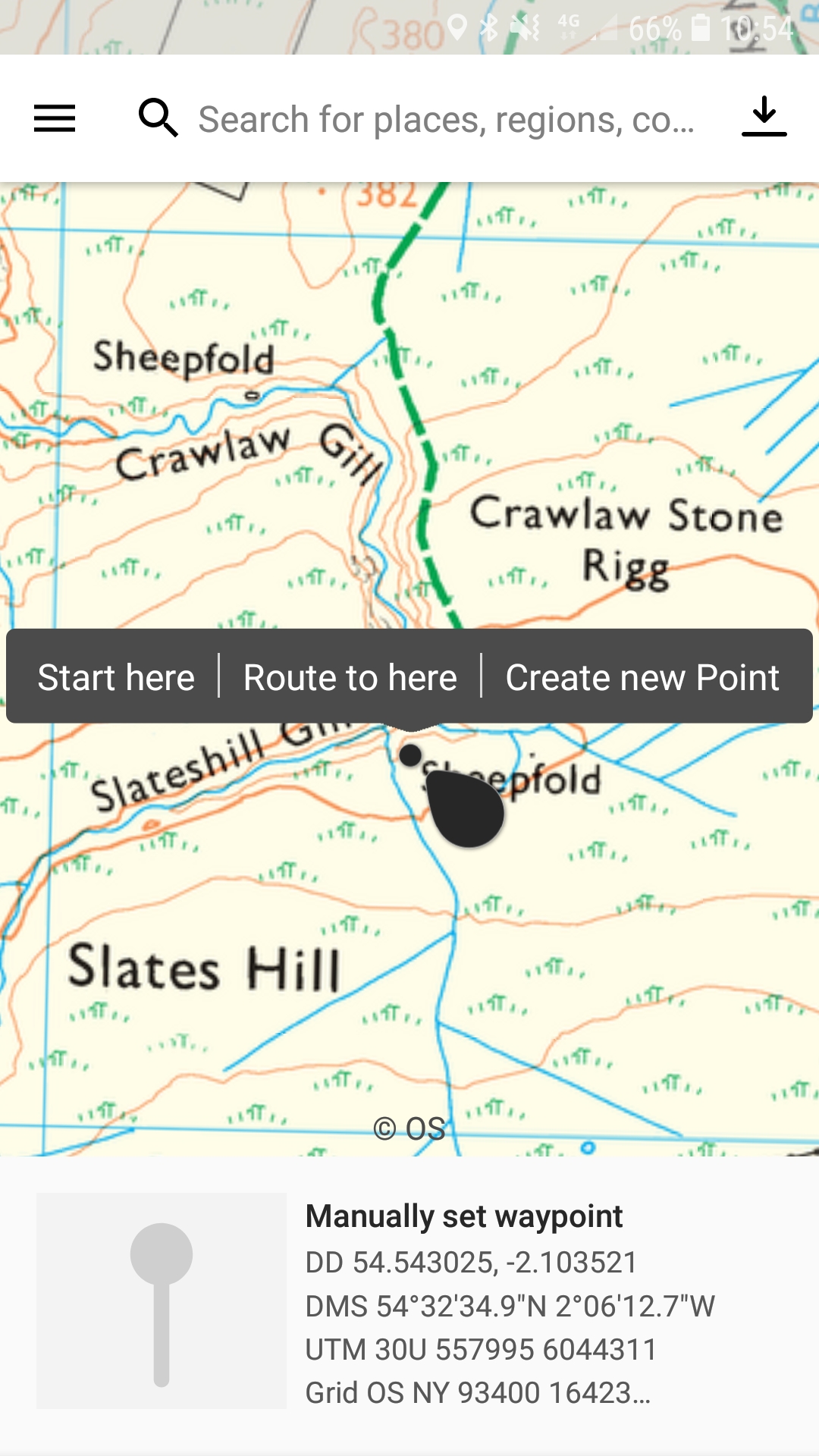
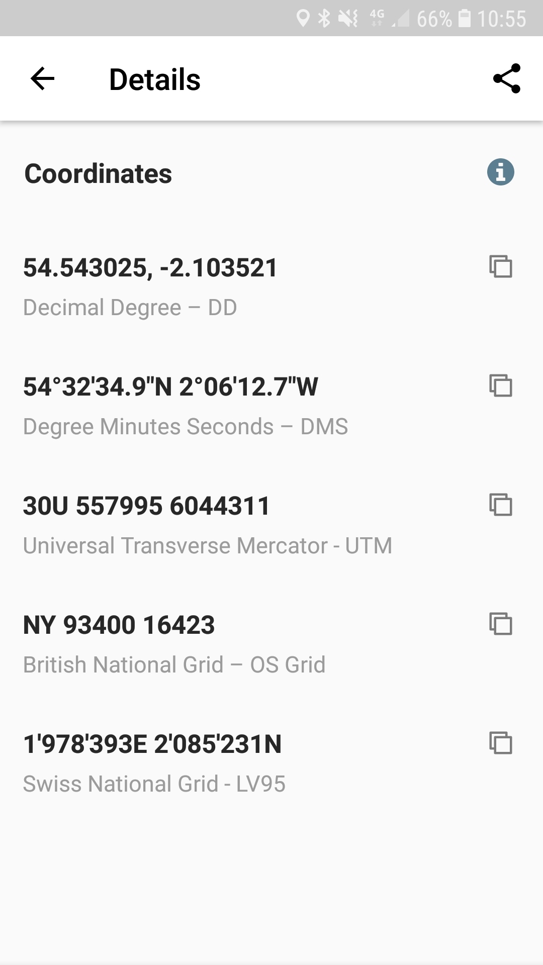
The mapping is clear, clearer than ViewRanger but not as good as Memory Map. The app is not quite so intuitive as ViewRanger though. Again, it took me a while to discover how to find the grid reference of specific points – you need to hold your finger on the screen like in OS maps and a black circle will appear in roughly the right location, but you can then fine tune the exact location by dragging the nearby black blob. Some co-ordinates will appear at the bottom of the screen but if you click on this data a huge list of different location data will appear including the OS Grid reference, What3Words, Decimal Degree, Swiss National Grid and Universal Transverse Mercator. There is the option to copy or share the co-ordinates of your location. If you want to find a particular grid reference on the map then you go to the Search option, then Enter Coordinates, then enter co-ordinates in any of the available formats and click Show on Map. The ability to use different formats for co-ordinates is brilliant but the process is not as intuitive as ViewRanger which had a rolling grid reference always on display.
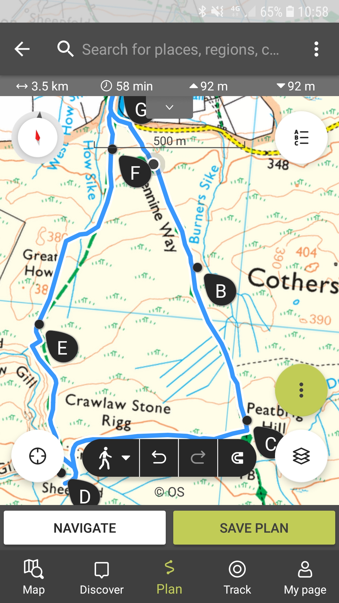
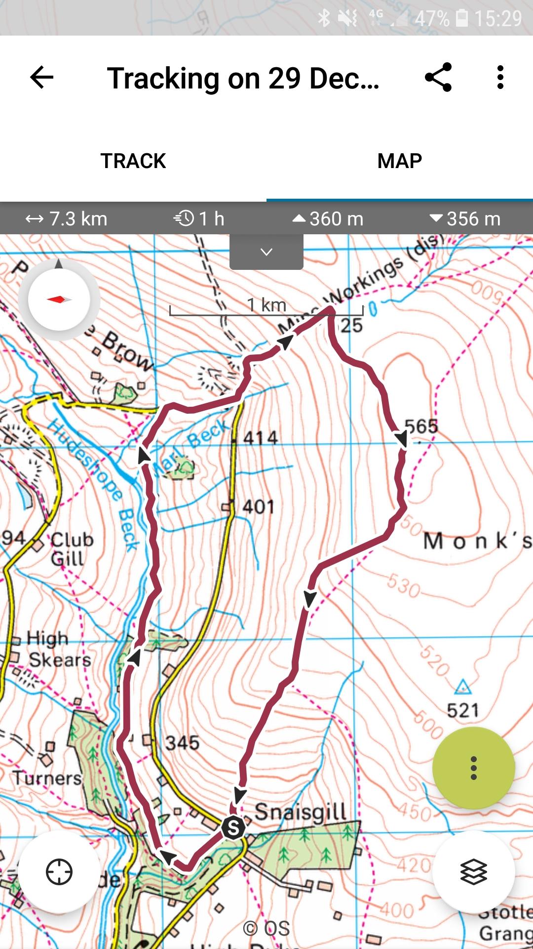
To plan a route you go to the Plan symbol at the bottom of the screen and then hold your finger down on the map to select waymarks as with all the other apps. One new feature is the option for your route to automatically follow the paths and tracks, removing the need to place a new waymark every time the track turns a corner. You can turn this option off and the route will revert to a straight line between the two waymarks. One difficulty I encountered was returning to the starting point with waymarks jumping all over the place if I tried to place one on my outward route. Instead I had to chose the “Same Way Back” or “Close loop” options which is a bit of a faff. But the data for the planned route is good with distance, ascent, descent, time and an elevation profile. The elevation profile is particularly useful and as you move your finger along it you are given distance and altitude at each point and a black circle on the mapped route moves as well.
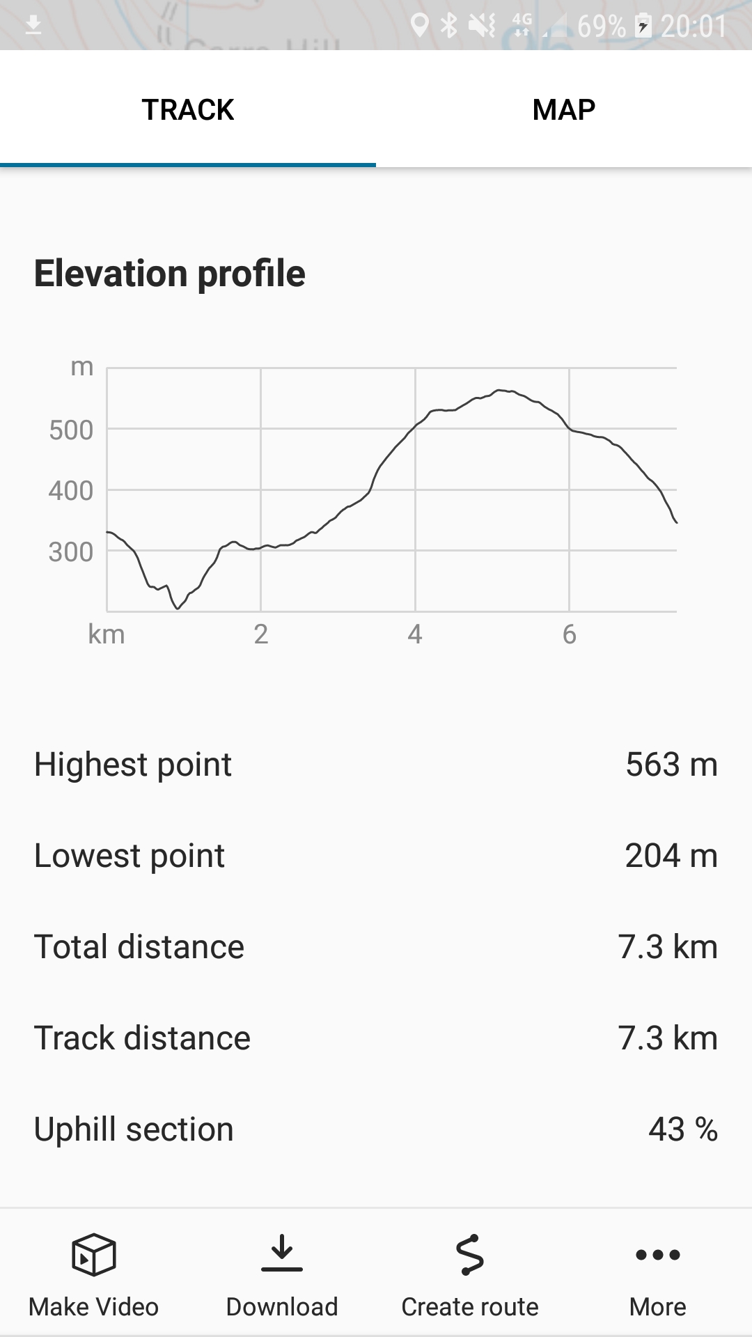
The tracking function is good with an impressive amount of data available afterwards including a map, elevation profile, distance, time, ascent, highest point, lowest point, % uphill, % downhill, time uphill, time downhill, average speed, maximum speed, average uphill and downhill speed. You can then turn your Track into a Route and Publish it to the Outdoor Active community with less statistics than are available to you.
To use the App offline you need to download specific map areas, larger areas than for OS Maps but not as large as in ViewRanger so it is more of a faff. Again, it’s hard to see what area has and has not been downloaded so I recommend turning off your 4g and having a look before you need to rely on it. Outdooractive does tell you when you have an offline map available for the area you are looking at and gives you the option to switch to offline use.
The BuddyBeacon option will be known to users of ViewRanger and allows family and friends to see your location via their Outdooractive app. A useful safety feature but I’m always slightly uncomfortable with the idea that someone is following my every move. I prefer the old fashioned method of leaving my route with someone, even if that does then restrict changes to my route. There are other functions which I don’t need as much including a Navigation feature which talks to you and tells you directions, Augmented Reality and a small compass on the screen.
As I used the three Apps it became obvious which one I would choose going forward. Outdooractive may not be as intuitive as ViewRanger and there is a bit too much clutter on the screen, but all the features are there plus plenty more and the Pro version offers good value for money. And even better, instead of spending hours poring over UK maps, I have a whole world of maps to explore.

I have now been ‘;forced’ to move from the excellent V to OA. 😦 and my battery life has plummeted, even when I am not actively using the app. So I am now looking for a replacement. Thank you for your comments, I shall try MemoryMap I think.
LikeLike