In July 2022 I walked the second half of the Stubai high level route, alone. I started from the Dresdner hutte where I’d left the route 28 years previously. Last time, aged 21, I had a university friend with me. This time, aged 49, my 11 year old daughter, Hannah, accompanied me for part of the first day.
Day 1 – Dresdner hutte to Neue Regensburgerhutte. 900m ascent, 12km.
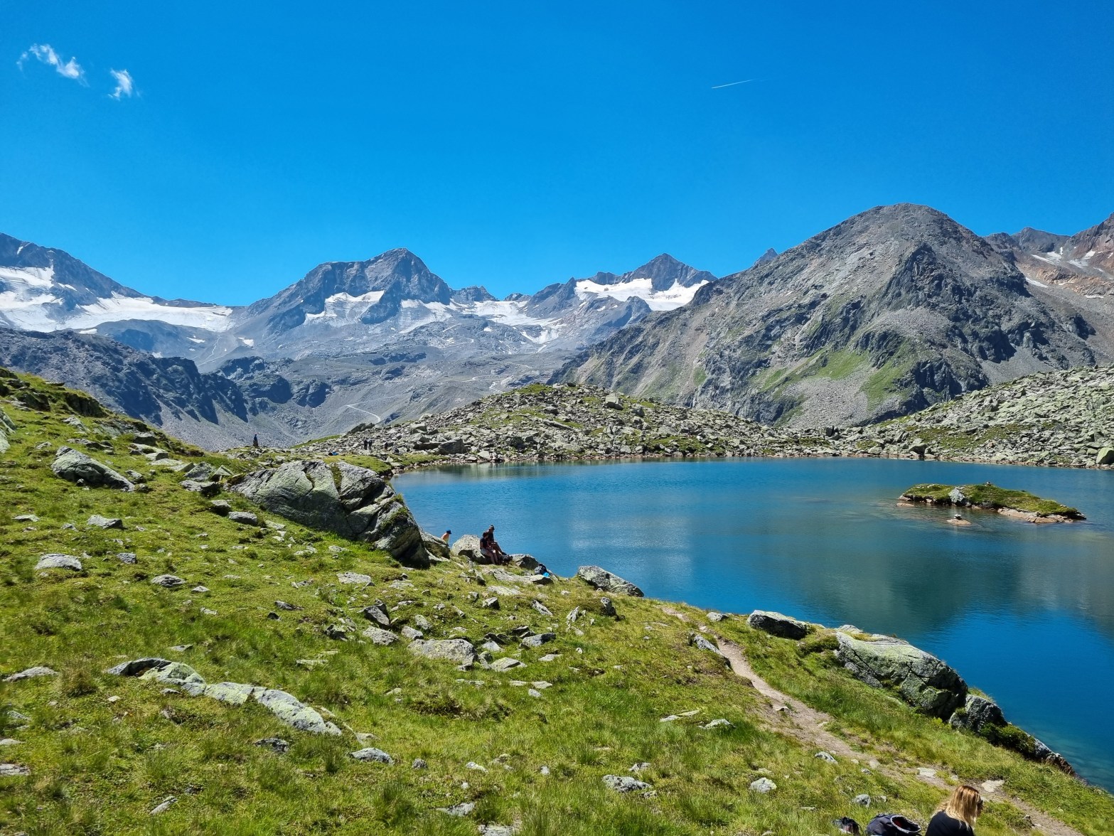
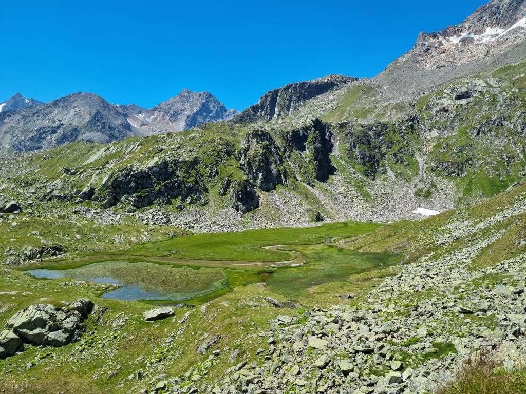
We got the cable car up to the Dresdner hutte at 2,308m and then headed west over the Egesenerjoch (Egesener pass) on a good path. From there we traversed round to the blue Mutterbergsee (Mutterberg lake) with great views back to the high snowy peaks of the Zuckerhutl and Wilder Freiger. It was a beautiful day, blue sky, sunny but not too hot and it was great to be back in the Alps after a Covid imposed gap of 3 years.
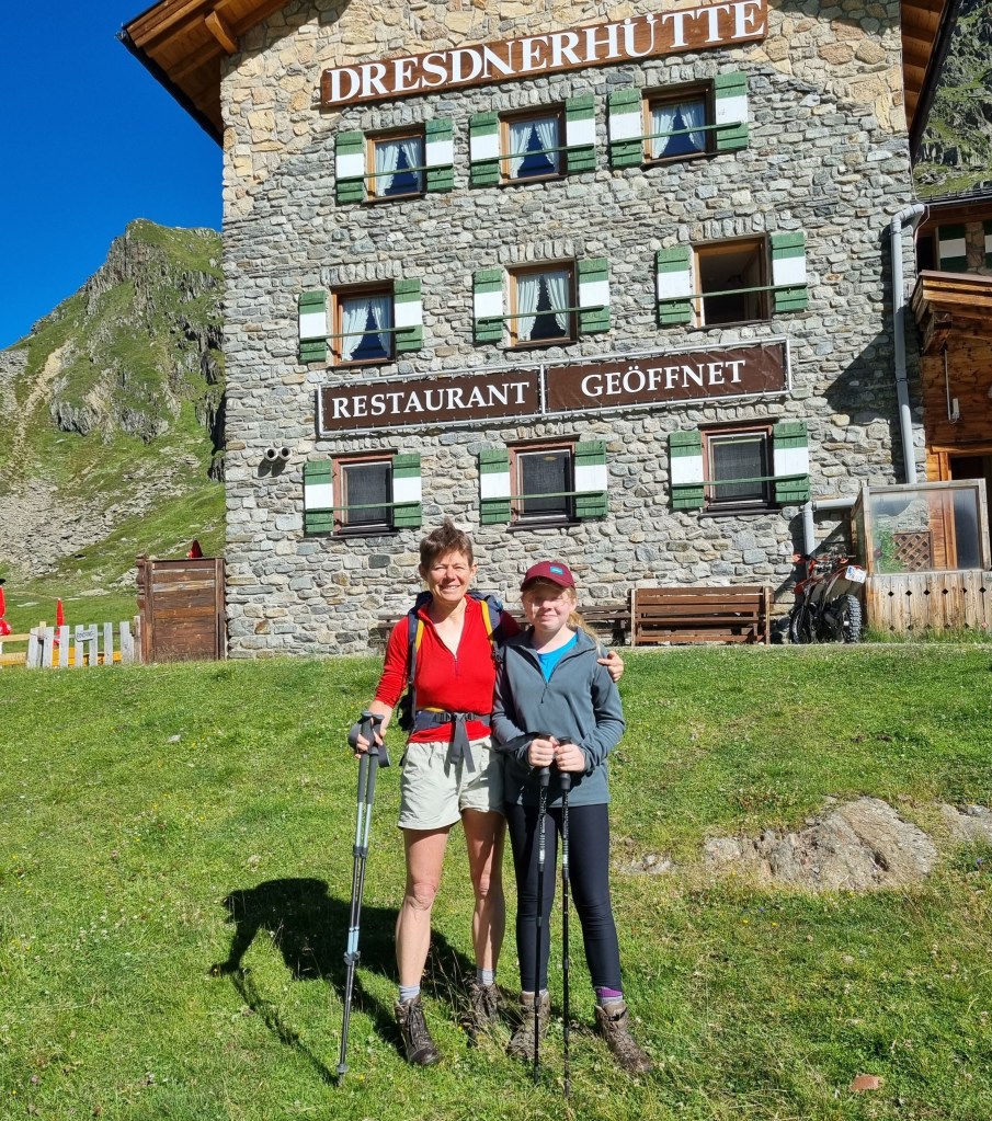
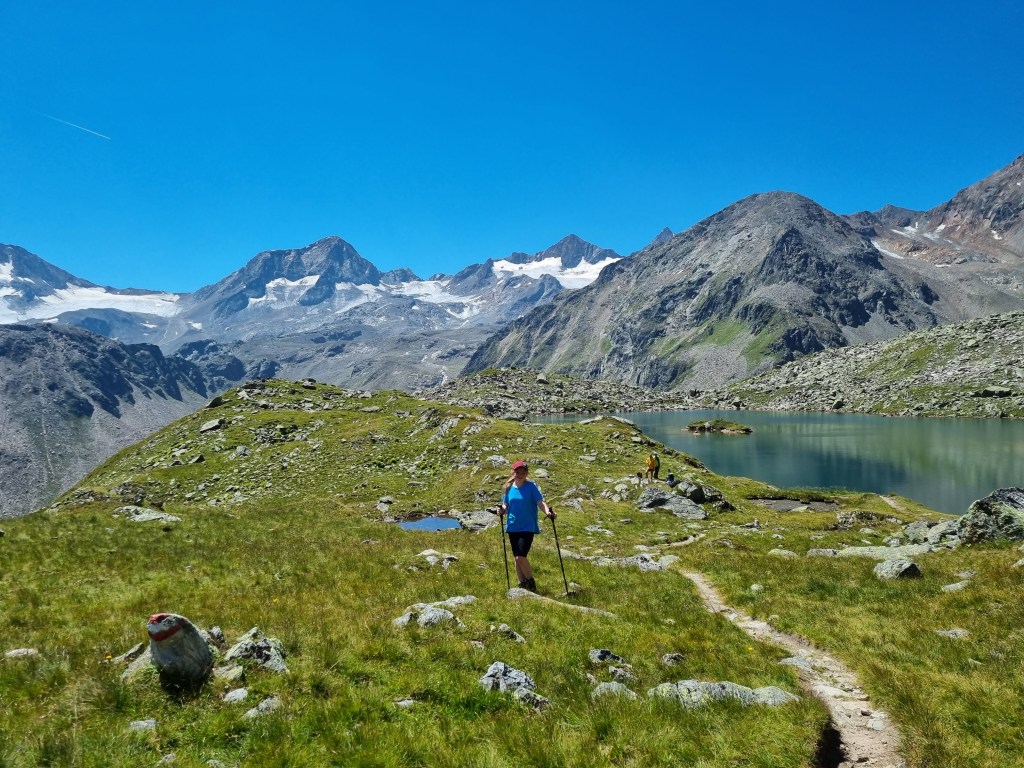

After the Mutterbergsee we parted ways, Hannah and James returning to the valley and me continuing on the Hohenweg (high route). Hannah and James were going to the family meet run by the UK section of the Austrian alpine club at the FranzSenn hutte a few valleys west and all being well I would meet up with them in a few days.
Now the adventure really started. I was alone in the high mountains and the path immediately became narrower, steeper and looser. The guidebook said 7 hours from the Dresdner hutte to the Neue Regensburgerhutte where I was headed but I had walked slowly on the first section with Hannah and I now had some catching up to do. Dinner was at 6pm and I didn’t want to go hungry.
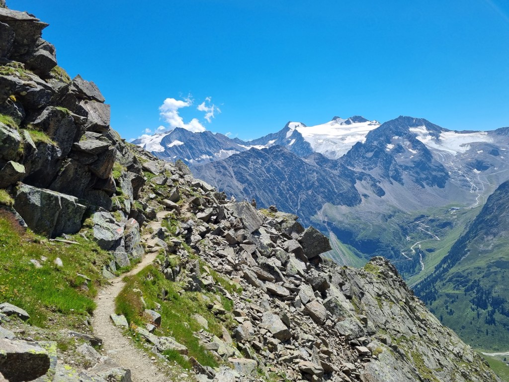
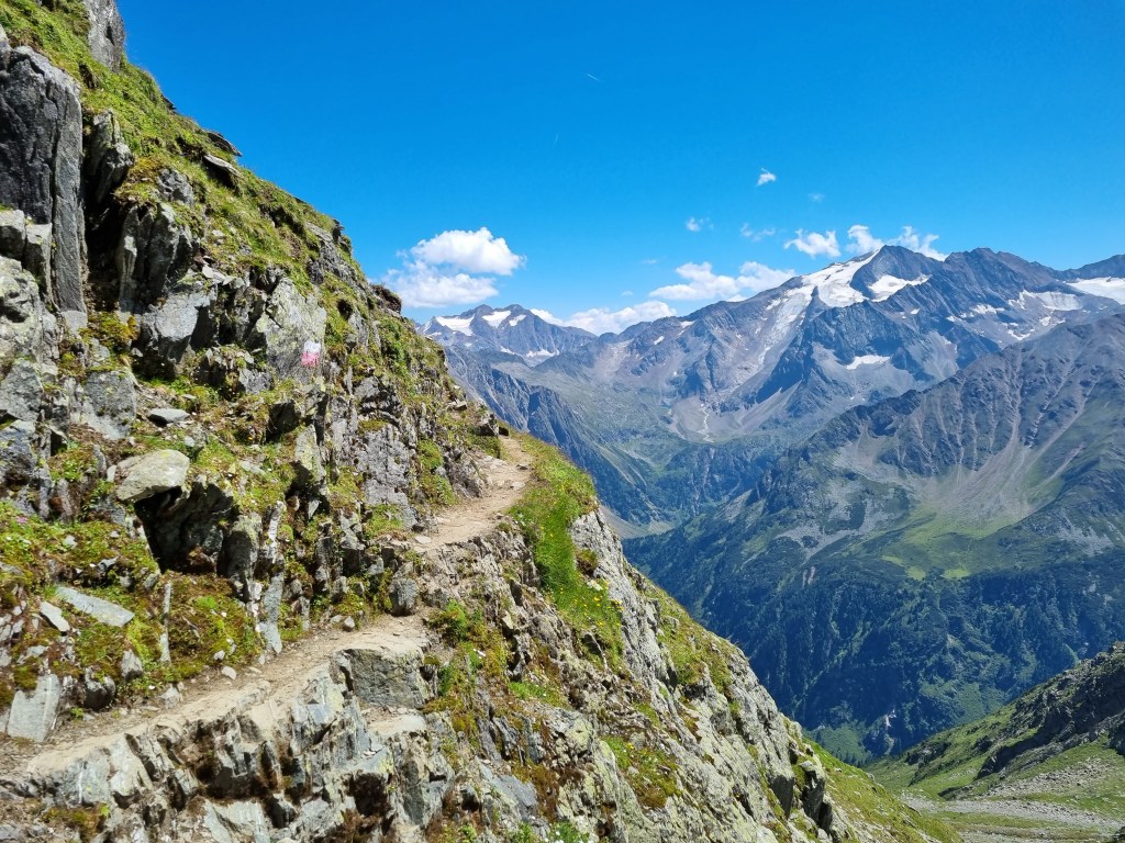
The path traversed around the mountainside, slowly getting higher. It crossed rocky ridges where it was equipped with a wire handrail to prevent walkers falling off the narrow path and over the precipice. I was reminded of a comment made by a friend about Crib Goch, many years ago – “It’s just like walking along a pavement but if you fall off you die”. Not hard, but not a place for those with vertigo. I heard a squawk from above and looked up to see two huge birds soaring above me. Eagles. Just me, the mountains and the eagles, just like Loch Mullardoch last summer.
I ran out of water and filled up from a mountain stream. Icy cold and delicious. Probably safe to drink but I didn’t want to take any chances so I threw a water purifying tablet in. The new chlorine dioxide tablets leave very little taste compared to the old chlorine tablets.
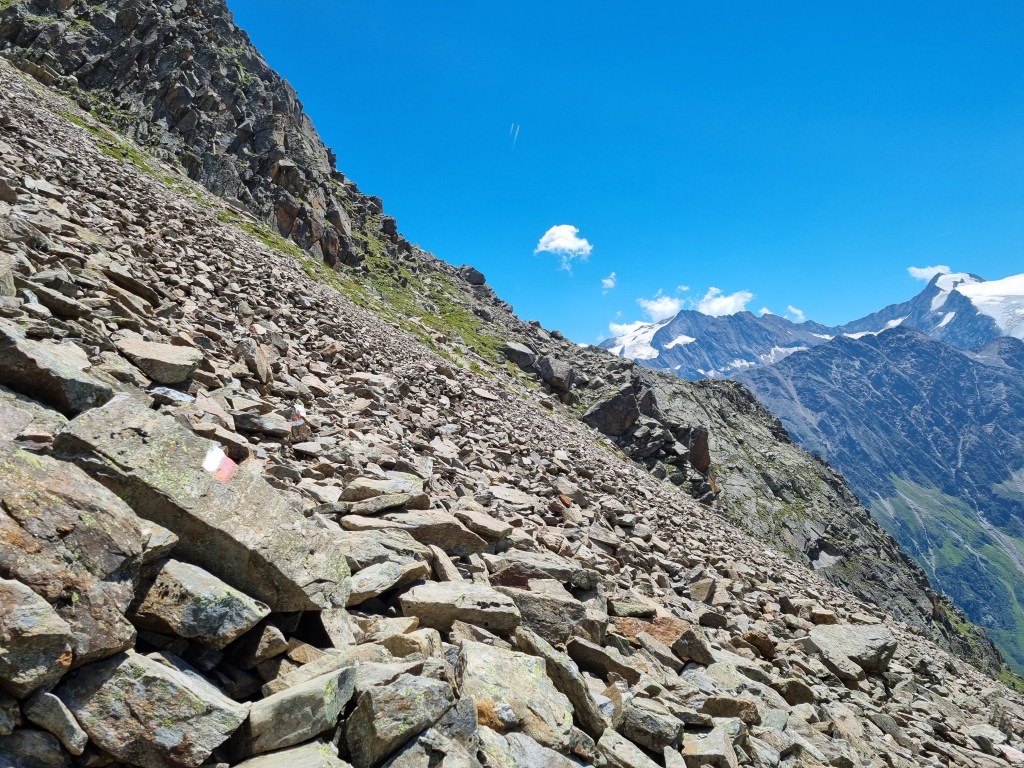
The first day was the longest and hardest section of my route. I had the Grabagrubernieder to cross which at 2881m was the highest point on the whole hohenweg and it had a reputation for being loose and nasty. I’d also only come out from England the day before and felt the altitude above 2500m where the walking felt slow and tiring.
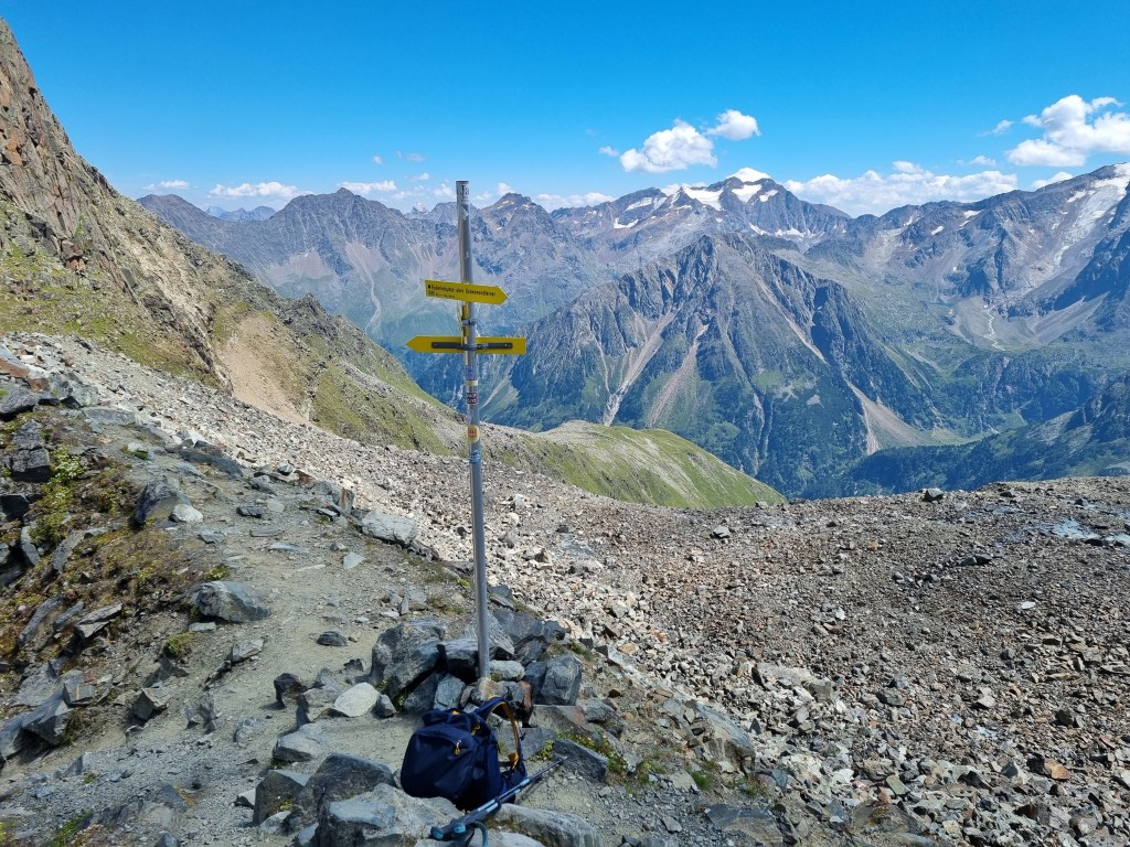
The narrow path wound its way slowly up to the pass. The last 200m or so was over an old glacier, now receded to leave large boulders. But it wasn’t steep and soon I was at the top of the pass with the usual yellow signposts pointing in all directions. It’s impossible to get lost in Austria – bright yellow signposts at every junction and red/white paint on boulders on the paths. Navigation becomes a game of dot-to-dot, looking for the next red paint mark on a huge boulder field.
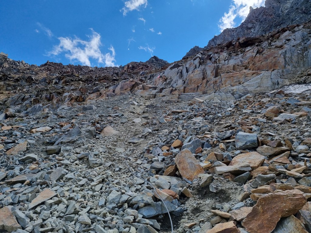
I could see the Neue Regensburgerhutte far below – an awful long way below and I had the most technical part of the Hohenweg to do to get there. From the col I had to descend steeply over rocks to another old glacier. Before the glacier had receded it would have been easy, but now there was steep, loose scree between the end of the steep rocks and the start of another boulder field. The steep rocks were fine and the path was equipped with wires at the steepest part. Then came the scree. A long wire cable hung down the steep scree slope, fixed at either end but not in the middle. I faced the scree, grabbed the cable and leaned back, taking huge steps down the scree and making fast progress, wishing I had my klettersteig gloves with me. It wasn’t pleasant but it would have been much worse without the cable. Soon I was at the boulder field which was solid and not nearly as steep and then it was a game of dot-to-dot once more.
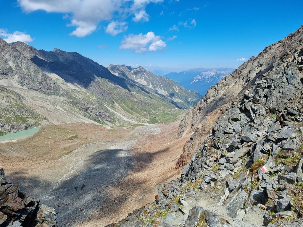

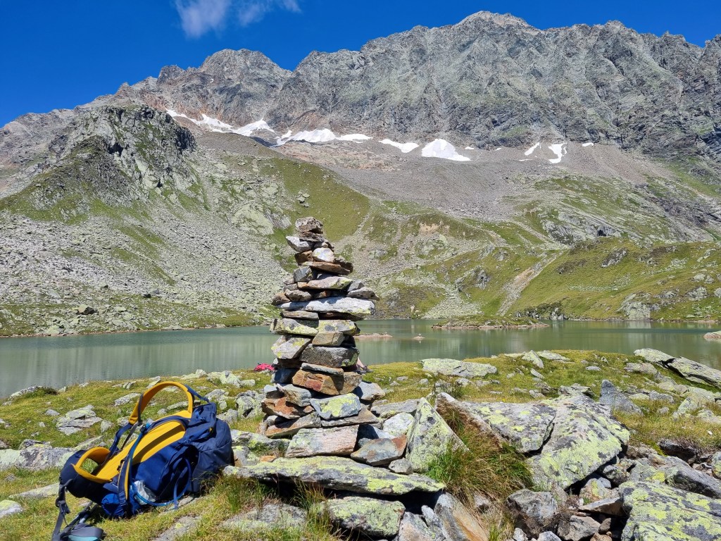
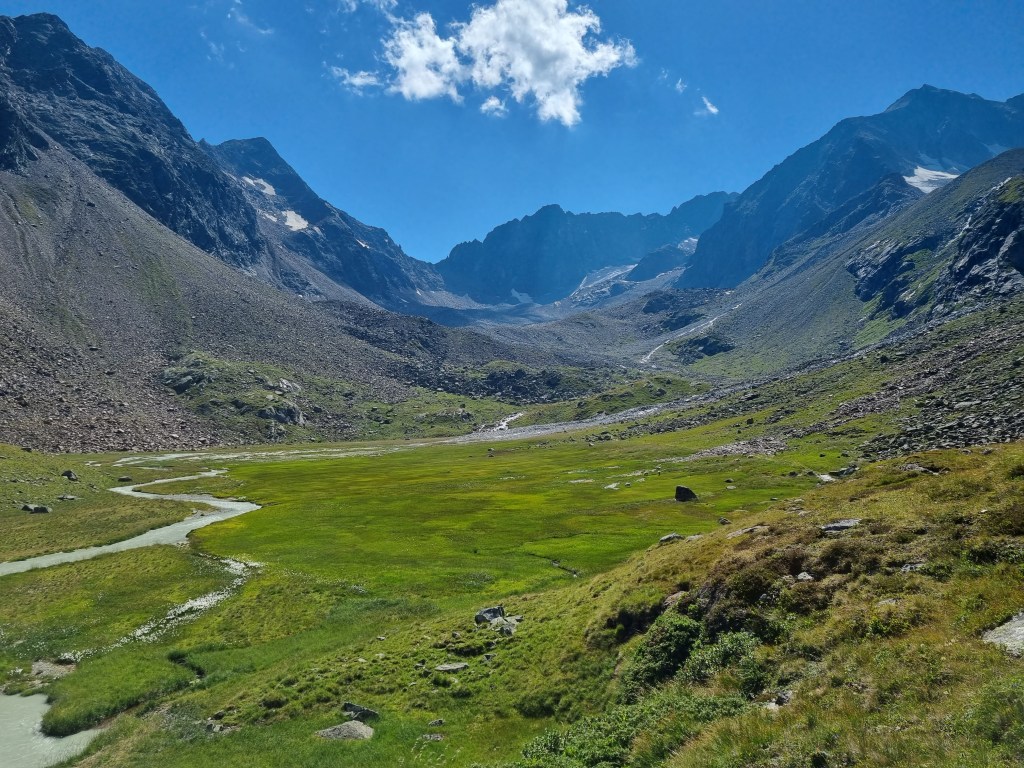
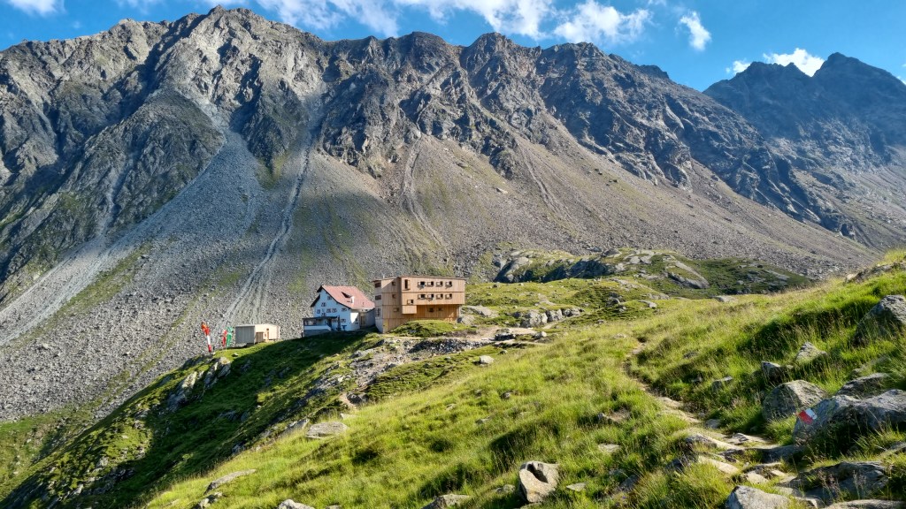
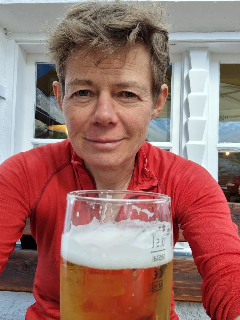
The path slowly improved. Steep scree to boulder field, boulder field to faint path over gravel, faint path to well defined path through grassy meadows. The hut was on a grassy shelf high above the valley at 2286m. Behind the hut was a lush, green meadow with a mountain stream running through the middle and sheep grazing. I reached the hut at 4pm, a 6 hour walk including the slow start. I sat down on the terrace, bought a large beer and relaxed.
To be continued……
Copyright of all text and photos – Jane Ascroft 2022
